
List of lakes of Yukon
This is an incomplete list of lakes of Yukon, a territory of Canada.

The largest lake of Yukon is Kluane Lake at 409 km2 (158 sq mi) located at an elevation of 781 m (2,562 ft).[1]
Gallery
[edit]-
 Atlin Lake is the largest lake partly in Yukon
 -
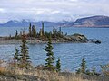 Kluane Lake is the largest entirely in Yukon
 -
 Lake Laberge in 2010
 -
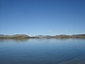
 Tagish Lake is the longest and deepest in the territory


List of lakes
[edit]| Lake | Length | Width | Area | Elevation | Average depth | Maximum depth | Notes | Sources | ||||||
|---|---|---|---|---|---|---|---|---|---|---|---|---|---|---|
| km | mi | km | mi | km2 | sq mi | m | ft | m | ft | m | ft | |||
| Aishihik Lake | 53 | 33 | 6 | 3.7 | 147.47 | 56.94 | 930 | 3,050 | 35.5 | 116 | 120 | 390 | [2]: 8 [3] | |
| Alligator Lake | 6.3 | 2.4 | 5.4 | 18 | [4] | |||||||||
| Annie Lake | 2.41 | 1.50 | 107 | 351 | Also partly in British Columbia | [5] | ||||||||
| Atlin Lake | 81 | 50 | 3–8 | 1.9–5.0 | 791 | 305 | 669 | 2,195 | 85.6 | 281 | 289 | 948 | Mostly in British Columbia | [6][7][8]: 14 |
| Barlow Lake | 1.2 | 0.75 | 0.7 | 0.43 | 0.9 | 0.35 | 610–760 | 2,000–2,490 | 5.5 | 18 | [8]: 15 | |||
| Bennett Lake | 41 | 25 | 3.7 | 2.3 | 96.80 | 37.37 | 656 | 2,152 | 61.9 | 203 | 123 | 404 | Also partly in British Columbia. | [2]: 32 [9][10][8]: 14 |
| Big Kalzas Lake | 42 | 16 | 780 | 2,560 | 65 | 213 | [4][11] | |||||||
| Black Lake (Munroe Lake) | 6.4 | 4.0 | 0.8 | 0.50 | Also partly in British Columbia | [12]: 40 | ||||||||
| Blind Lake | [13]: 79 | |||||||||||||
| Bonnet Plume Lake | 3.7 | 1.4 | 1,067–1,121 | 3,501–3,678 | 12 | 39 | [8]: 13 | |||||||
| Braeburn Lake | 6.2 | 3.9 | 1.9 | 1.2 | 5.62 | 2.17 | 695 | 2,280 | 14.3 | 47 | 50 | 160 | [2]: 34 [8]: 14 | |
| Bruce Lake | 4.4 | 2.7 | 2.5 | 0.97 | 760–910 | 2,490–2,990 | 35 | 115 | [8]: 14 | |||||
| Cantile Lake | 2.17 | 0.84 | 901 | 2,956 | 18 | 59 | [14]: 16 | |||||||
| Canyon Lake | [3] | |||||||||||||
| Caribou Lake | 1.6 | 0.99 | 0.8 | 0.50 | 0.52 | 0.20 | 820 | 2,690 | 16.5 | 54 | [2]: 36 [12]: 61 | |||
| Chadburn Lake | 4.5 | 2.8 | 1.1 | 0.68 | 1.44 | 0.56 | 877 | 2,877 | 15 | 49 | 43 | 141 | [2]: 40 | |
| Chadden Lake | 0.55 | 0.21 | 661 | 2,169 | 30 | 98 | [14]: 12 | |||||||
| Chapman Lake | 2 | 1.2 | 1.3 | 0.81 | 1.29 | 0.50 | 981 | 3,219 | 8 | 26 | 12 | 39 | [15]: PDF page 44 [8]: 13 | |
| Chootla Lake | [16]: 13 | |||||||||||||
| Claire Lake | 24 | 15 | 1.6 | 0.99 | 20.4 | 7.9 | 53 | 174 | [4][13]: 86 [17] | |||||
| Clark Lake | 3.0 | 1.2 | 610–760 | 2,000–2,490 | 23 | 75 | [8]: 15 | |||||||
| Coffee Lake | 1.36 | 0.53 | 814 | 2,671 | [14]: 36 | |||||||||
| Coghlan Lake | 8 | 5.0 | 1.6 | 0.99 | 8.23 | 3.18 | 24 | 79 | [4][12]: 96 [13]: 87 | |||||
| Crag Lake | 5.6 | 3.5 | 1.2 | 0.75 | 5.67 | 2.19 | 760 | 2,490 | [13]: 87 [12]: 25 | |||||
| Crystal Lake | 2.5 | 1.6 | 0.8 | 0.50 | 1.77 | 0.68 | 760–915 | 2,493–3,002 | [8]: 15 | |||||
| Dalayee Lake | 10.3 | 6.4 | 1.6 | 0.99 | 10.6 | 4.1 | 970 | 3,180 | 46 | 151 | [13]: 87 [8]: 15 | |||
| Daughney Lake | 6 | 3.7 | 4.8 | 1.9 | 915–1,065 | 3,002–3,494 | 27 | 89 | [8]: 13 | |||||
| Davis Lake (north) | 2.5 | 1.6 | 2.8 | 1.1 | 305–460 | 1,001–1,509 | 23 | 75 | [8]: 13 | |||||
| Davis Lake (south) | 2.5 | 1.6 | 305–460 | 1,001–1,509 | 27 | 89 | [8]: 13 | |||||||
| Dezadeash Lake | 19 | 12 | 9.7 | 6.0 | 82.50 | 31.85 | 690 | 2,260 | 4.1 | 13 | 7.4 | 24 | [2]: 10 [18][19][8]: 13 | |
| Diamain Lake | 10 | 6.2 | 2 | 1.2 | 18.80 | 7.26 | 460–610 | 1,510–2,000 | 25 | 82 | [8]: 14 | |||
| Divide Lake | 10.4 | 6.5 | 0.2 | 0.12 | 0.2 | 0.077 | 1,040 | 3,410 | 10.4 | 34 | [8]: 13 | |||
| Dog Lake | 1.9 | 1.2 | 0.5 | 0.31 | 0.8 | 0.31 | 300–460 | 980–1,510 | [8]: 13 | |||||
| Dogpack Lake | 1.76 | 0.68 | [13]: 87 | |||||||||||
| Dragon Lake | 16 | 9.9 | 0.6 | 0.37 | 7.3 | 2.8 | 760–910 | 2,490–2,990 | 10 | 33 | [8]: 14 | |||
| Drury Lake | 24 | 15 | 0.27 | 0.10 | 715 | 2,346 | 295 | 968 | [13]: 87 [20] | |||||
| Duo Lake | 0.24 | 0.093 | 1,200 | 3,900 | [13]: 80 [21] | |||||||||
| Dwarf Lake | 0.5 | 0.19 | 760–910 | 2,490–2,990 | 18 | 59 | [8]: 15 | |||||||
| Earn Lake | 35.53 | 13.72 | [13]: 87 | |||||||||||
| Elliot Lake | 1.9 | 1.2 | 0.8 | 0.50 | 1.13 | 0.44 | 915–1,065 | 3,002–3,494 | 22 | 72 | [8]: 13 | |||
| Emerald Lake | [22] | |||||||||||||
| Enger Lake | 1.17 | 0.45 | 741 | 2,431 | 6.3 | 21 | 16 | 52 | [15]: PDF page 65 | |||||
| Ess Lake | 13.300 | 5.135 | [13]: 87 | |||||||||||
| Ethel Lake | 21 | 13 | 2.5 | 1.6 | 46.10 | 17.80 | 760 | 2,490 | 31 | 102 | 62 | 203 | [2]: 42 [23][8]: 15 | |
| Fairchild Lake | 4.0 | 2.5 | 0.8 | 0.50 | 1.69 | 0.65 | 610–760 | 2,000–2,490 | 4.5 | 15 | [8]: 13 | |||
| Fairweather Lake | 12 | 7.5 | 3 | 1.9 | 18.90 | 7.30 | [13]: 87 [24]: 30 | |||||||
| Finlayson Lake | 14.5 | 9.0 | 2.2 | 1.4 | 20.70 | 7.99 | 946 | 3,104 | 11.3 | 37 | [13]: 86 [8]: 13 | |||
| Fire Lake | [13]: 79 | |||||||||||||
| Fish Lake | 11.3 | 7.0 | 1.2 | 0.75 | 13.86 | 5.35 | 1,123 | 3,684 | 16.5 | 54 | 37 | 121 | [2]: 44 [12]: 96 | |
| Fisheye Lake | 0.36 | 0.14 | 773 | 2,536 | 7.6 | 25 | 21 | 69 | Sources differ on spelling "Fisheye" or "Fish Eye" | [14]: 34 [15]: PDF page 69 | ||||
| Fortin Lake | 14.98 | 5.78 | [13]: 88 | |||||||||||
| Fox Lake | 4 | 2.5 | 0.8 | 0.50 | 16.02 | 6.19 | 957 | 3,140 | 28.6 | 94 | 47 | 154 | [2]: 50 [12]: 61 | |
| Frances Lake | 37 | 23 | 2.4 | 1.5 | 99.41 | 38.38 | 734 | 2,408 | 93 | 305 | 31 | 102 | [2]: 21 [8]: 13 | |
| Frank Lake | 12.9 | 8.0 | 0.8 | 0.50 | 5.86 | 2.26 | [12]: 95 [13]: 88 | |||||||
| Frederick Lake | 9 | 5.6 | 0.7 | 0.43 | 4.45 | 1.72 | 703–762 | 2,306–2,500 | 24.5 | 80 | [13]: 88 [8]: 13 | |||
| Frenchman Lake | 18 | 11 | 1.6 | 0.99 | 14.41 | 5.56 | 575 | 1,886 | 14.6 | 48 | 65 | 213 | [2]: 52 | |
| Gillespie Lake | 2.8 | 1.7 | 0.5 | 0.31 | 0.63 | 0.24 | 1,370 | 4,490 | 22.3 | 73 | [8]: 13 | |||
| Gladstone Lake - Central | 0.29 | 0.11 | [13]: 88 | |||||||||||
| Gladstone Lake - North | 0.24 | 0.093 | [13]: 88 | |||||||||||
| Gladstone Lake - South | 0.79 | 0.31 | [13]: 89 | |||||||||||
| Glenlyon Lake | [13]: 79 | |||||||||||||
| Gloria Lake II | 0.09 | 0.035 | 507 | 1,663 | 20 | 66 | [14]: 30 | |||||||
| Granite Lake | 1.74 | 0.67 | [13]: 89 | |||||||||||
| Grass Lakes | [13]: 79 | |||||||||||||
| Gravel Lake | 0.38 | 0.15 | 628 | 2,060 | 0.9 | 3.0 | [15]: PDF page 73 | |||||||
| Haldane Lake | 0.10 | 0.039 | 691 | 2,267 | [14]: 38 | |||||||||
| Halfway Lake – East | 1.5 | 0.93 | 760 | 2,490 | 4.2 | 14 | Elevation given is a maximum figure | [8]: 15 [25] | ||||||
| Halfway Lake – West | 1.5 | 0.93 | 0.9 | 0.35 | 760 | 2,490 | 4.7 | 15 | Elevation given is a maximum figure | [8]: 15 [25] | ||||
| Hanson Lake – North | 1.0 | 0.39 | 760 | 2,490 | 19 | 62 | Elevation given is a maximum figure | [8]: 15 [25] | ||||||
| Hanson Lake – South | 5.0 | 3.1 | 0.8 | 0.50 | 3.2 | 1.2 | 760 | 2,490 | 33 | 108 | Elevation given is a maximum figure | [8]: 15 | ||
| Hidden Lake 1 | 0.34 | 0.13 | 665 | 2,182 | 20 | 66 | [14]: 10 | |||||||
| Hidden Lake 3 | 0.04 | 0.015 | 665 | 2,182 | 15 | 49 | [14]: 10 | |||||||
| Hour Lake | 0.03 | 0.012 | 689 | 2,260 | [14]: 24 | |||||||||
| Howard Lake - North | 2.00 | 0.77 | [13]: 89 | |||||||||||
| Howard Lake - South | 0.59 | 0.23 | [13]: 89 | |||||||||||
| Hungry Lake | 8 | 5.0 | 6.6 | 2.5 | 305–460 | 1,001–1,509 | 4 | 13 | [8]: 13 | |||||
| Hutshi Lake – Central | 3.24 | 1.25 | [13]: 89 | |||||||||||
| Hutshi Lake – North | 5.10 | 1.97 | [13]: 89 | |||||||||||
| Ibex Lake | 0.31 | 0.12 | [13]: 89 | |||||||||||
| Jackfish Lake (Yukon) | 1.14 | 0.44 | 797 | 2,615 | 5.3 | 17 | 21 | 69 | [15]: PDF page 75 | |||||
| Janet Lake | 11 | 6.8 | 2 | 1.2 | 17.2 | 6.6 | 572 | 1,877 | 103 | 338 | [8]: 15 | |||
| Jim Cook (Tele) Lake | 4.78 | 1.85 | 1,150 | 3,770 | [13]: 79 [26] | |||||||||
| Jojo Lake | 11 | 6.8 | 1.6 | 0.99 | 6.4 | 2.5 | 888 | 2,913 | 31 | 102 | 52 | 171 | Sometimes spelled "Jo-Jo" | [4][12]: 69 [8]: 15 |
| Judas Lake | 0.04 | 0.015 | 732 | 2,402 | 12 | 39 | [14]: 20 | |||||||
| Kathleen Lake | 33.76 | 13.03 | 731 | 2,398 | 52.2 | 171 | 111 | 364 | [27]: 1 | |||||
| Kathleen Lake – Lower | 11.0 | 6.8 | 8.0 | 5.0 | 33.8 | 13.1 | 734.5 | 2,410 | [8]: 13 | |||||
| Kathleen Lake – Upper | 5.5 | 3.4 | 1.4 | 0.87 | 5.38 | 2.08 | 736 | 2,415 | 110 | 360 | [8]: 13 | |||
| Kloo Lake | 11.61 | 4.48 | 837 | 2,746 | 13 | 43 | 12 | 39 | [15]: PDF page 30 [25] | |||||
| Kluane Lake | 81 | 50 | 8 | 5.0 | 408.21 | 157.61 | 781 | 2,562 | 31 | 102 | 91 | 299 | Largest lake entirely within Yukon | [2]: 58 [28][8]: 15 |
| Klukshu Lake | 5 | 3.1 | 0.5 | 0.31 | 1.29 | 0.50 | 706 | 2,316 | 21.5 | 71 | 31 | 102 | [15]: PDF page 32 | |
| Kookatsoon Lake | 0.8 | 0.50 | 0.18 | 0.069 | 762 | 2,500 | [8]: 14 | |||||||
| Kusawa Lake | 74 | 46 | 0.8–2.4 | 0.50–1.49 | 140.18 | 54.12 | 671 | 2,201 | 54 | 177 | 140 | 460 | [2]: 60 [12]: 67 | |
| Ladue Lake | 2.4 | 0.93 | 760 | 2,490 | 24 | 79 | Elevation given is a maximum figure | [8]: 15 | ||||||
| Lake 13-562 | 0.23 | 0.089 | 698 | 2,290 | 4.5 | 15 | 7 | 23 | Unnamed lake about 3 km (1.9 mi) north of Watson Lake. | [15]: PDF page 38 | ||||
| Lake 13-563 | 0.12 | 0.046 | 831 | 2,726 | 2.5 | 8.2 | 3 | 9.8 | Unnamed lake adjacent to Frances Lake. | [15]: PDF page 40 | ||||
| Lake 13-587 | 0.11 | 0.042 | 664 | 2,178 | 4 | 13 | 6 | 20 | Unnamed lake adjacent to Marsh Lake. | [15]: PDF page 61 | ||||
| Lake 14-584 | 0.21 | 0.081 | 1,121 | 3,678 | 5.3 | 17 | Unnamed lake in Tombstone Territorial Park | [15]: PDF page 42 | ||||||
| Lake Laberge | 50 | 31 | 2.5–6.5 | 1.6–4.0 | 200.99 | 77.60 | 628 | 2,060 | 54 | 177 | 146 | 479 | [2]: 64 [12]: 77 [29] | |
| Lewes Lake | 1.31 | 0.51 | 728 | 2,388 | 17 | 56 | 40 | 130 | [2]: 66 | |||||
| Little Atlin Lake | 23 | 14 | 2.5–3 | 1.6–1.9 | 40.32 | 15.57 | 669 | 2,195 | 10.6 | 35 | 42 | 138 | [2]: 68 [12]: 10 | |
| Little Braeburn Lake | 0.79 | 0.31 | [13]: 90 | |||||||||||
| Little Fox Lake | 2.27 | 0.88 | 818 | 2,684 | 50 | 160 | [2]: 73 | |||||||
| Little Fox Lake – North basin | 16.3 | 53 | 44 | 144 | [2]: 73 | |||||||||
| Little Fox Lake – South basin | 1.37 | 0.53 | 10.7 | 35 | 50 | 160 | [2]: 73 [30] | |||||||
| Little Kalzas Lake | 9.93 | 3.83 | [13]: 90 | |||||||||||
| Little Salmon Lake | 33 | 21 | 1.6 | 0.99 | 63.21 | 24.41 | 885 | 2,904 | 92.6 | 304 | 155 | 509 | [2]: 75 [31]: 3, 9 [8]: 14 | |
| Little Teslin Lake | 3.2 | 2.0 | 1.2 | 0.75 | 3.2 | 1.2 | 794 | 2,605 | 20 | 66 | [32]: 10 [33][8]: 15 | |||
| Little Wolverine Lake | [13]: 79 | |||||||||||||
| Long Lake | 1.3 | 0.81 | 0.34 | 0.13 | 665 | 2,182 | 15 | 49 | [14]: 14 [8]: 14 | |||||
| Louise Lake (Jackson Lake) | 0.58 | 0.22 | 1,020 | 3,350 | 6.8 | 22 | 13 | 43 | [2]: 77 | |||||
| Lower Snafu Lake | 9.5 | 5.9 | 0.8 | 0.50 | 2.84 | 1.10 | 759 | 2,490 | 6.3 | 21 | 25 | 82 | [2]: 93 [12]: 11 [34] | |
| Lucky Lake | 0.04 | 0.015 | 670 | 2,200 | Features the only outdoor waterslide north of 60° lattitude.[35] | [14]: 25 | ||||||||
| Mandanna Lake | 6 | 3.7 | 4.5 | 2.8 | 8.5 | 3.3 | 781 | 2,562 | 21 | 69 | 64 | 210 | Sinclair (2021) gives the area as 786 ha (7.86 km2; 3.03 sq mi)[2]: 79 | [2]: 79 [36] |
| Margaret Lake | 5 | 3.1 | 1.5 | 0.93 | 4.5 | 1.7 | 490 | 1,610 | 26 | 85 | [8]: 13 | |||
| Marsh Lake | 40 | 25 | 4 | 2.5 | 95.54 | 36.89 | 660 | 2,170 | 12.8 | 42 | 51.5 | 169 | [2]: 81 [12]: 54 | |
| Marshall Lake | 1.8 | 1.1 | 0.5 | 0.31 | 0.44 | 0.17 | 1,430 | 4,690 | 2.1 | 6.9 | [8]: 13 | |||
| Mayo Lake | 35.4 | 22.0 | 3.2 | 2.0 | 99.63 | 38.47 | 583 | 1,913 | 56.5 | 185 | 106 | 348 | [2]: 83 [8]: 15 | |
| McClinktock | 2.8 | 1.7 | 1.3 | 0.81 | 1.8 | 0.69 | 790–825 | 2,592–2,707 | 22.0 | 72.2 | [8]: 14 | |||
| McEvoy Lake | 19.04 | 7.35 | [13]: 91 | |||||||||||
| McLean Lake | 0.026 | 0.010 | 7 | 23 | [12]: 136 | |||||||||
| McPherson Lake | 9.27 | 3.58 | [13]: 91 | |||||||||||
| McQuesten Lake | 19 | 12 | 3 | 1.9 | 12.30 | 4.75 | 760 | 2,490 | 8 | 26 | Elevation given is a maximum figure | [24]: 33 [13]: 91 [8]: 15 | ||
| Michie Lake | 4 | 2.5 | 1.5 | 0.93 | 3.71 | 1.43 | 795 | 2,608 | 15 | 49 | 50 | 160 | [2]: 85 [4][12]: 60 | |
| Minto Lake | 3.7 | 2.3 | 1.3 | 0.81 | 4.20 | 1.62 | 761 | 2,497 | 13.8 | 45 | 37 | 121 | [2]: 87 [8]: 15 | |
| Moose Lake | 13.85 | 5.35 | [13]: 91 | |||||||||||
| Moose Ponds | Almost entirely in the Northwest Territories. | [37] | ||||||||||||
| Moraine Lake | 7 | 4.3 | 4.2 | 1.6 | 910–1,070 | 2,990–3,510 | 32 | 105 | [8]: 13 | |||||
| Morley Lake | 11.14 | 4.30 | 814 | 2,671 | 8.07 | 26.5 | 30 | 98 | [2]: 89 | |||||
| Morris | [13]: 80 | |||||||||||||
| Nares Lake | 4.5 | 2.8 | 2.6 | 1.6 | 107.15 | 41.37 | 1,000 | 3,300 | 15 | 49 | [12]: 25 [38][8]: 14 | |||
| North Fork Lake | 0.9 | 0.56 | 0.8 | 0.50 | 0.16 | 0.062 | 1,067–1,220 | 3,501–4,003 | 3.6 | 12 | [8]: 13 | |||
| North Lakes | [13]: 80 | |||||||||||||
| Palmer Lake | 1.6 | 0.99 | 0.8 | 0.50 | 1.0 | 0.39 | 670–760 | 2,200–2,490 | 13.7 | 45 | [8]: 14 | |||
| Partridge Lake | 6 | 3.7 | 0.8 | 0.50 | Also partly in British Columbia | [12]: 40 | ||||||||
| Pelly Lake | 19.80 | 7.64 | [13]: 91 | |||||||||||
| Pickhandle Lake | 1.63 | 0.63 | [13]: 91 | |||||||||||
| Pine Lake | 5.5 | 3.4 | 0.8 | 0.50 | 6.03 | 2.33 | 625 | 2,051 | 14.7 | 48 | 28 | 92 | [2]: 14 [39][8]: 13 | |
| Pine Lake 1 | 0.20 | 0.077 | 995 | 3,264 | 4.6 | 15 | 10 | 33 | [15]: PDF page 46 | |||||
| Pine Lake 2 | 5.85 | 2.26 | 650 | 2,130 | 11.8 | 39 | 26 | 85 | [15]: PDF page 34 | |||||
| Pinguicula Lake | 3.2 | 2.0 | 0.5 | 0.31 | 1.13 | 0.44 | 914 | 2,999 | 12.2 | 40 | [8]: 13 | |||
| Pleasant | [13]: 80 | |||||||||||||
| Pocket Lake | 0.063 | 0.024 | 610 | 2,000 | 16.7 | 55 | Formerly called Moose Lake | [14]: 39 [40] | ||||||
| Poisson Lake | [13]: 80 | |||||||||||||
| Polecat Lake | 1.68 | 0.65 | [13]: 92 | |||||||||||
| Popcornfish Lake | 2.2 | 1.4 | 0.2 | 0.12 | 0.56 | 0.22 | 750 | 2,460 | 12.2 | 40 | [8]: 13 | |||
| Pygmy Lake | 0.5 | 0.19 | 18 | 59 | [25] | |||||||||
| Quiet Lake | 28 | 17 | 3.2 | 2.0 | 54.41 | 21.01 | 787 | 2,582 | 56.8 | 186 | 170 | 560 | Headwaters of the Big Salmon River. Some sources give the length as 12 km (7.5 mi), the area as 3,780 ha (37.8 km2; 14.6 sq mi) and the average depth as 32.9 m (108 ft),[31]: 4, 10 [13]: 92 but this conflicts with map evidence. | [2]: 91 [41][8]: 14 |
| Rainbow Lake | 1.44 | 0.56 | 610–735 | 2,001–2,411 | 2 | 6.6 | [8]: 13 | |||||||
| Rantin Lake | 0.07 | 0.027 | 723 | 2,372 | 12 | 39 | [14]: 26 | |||||||
| Reid Lake | 5.6 | 3.5 | 3.5 | 2.2 | 14.8 | 5.7 | 460–610 | 1,510–2,000 | 15.5 | 51 | [8]: 15 | |||
| Salmo Lake | 0.03 | 0.012 | 796 | 2,612 | 8 | 26 | [14]: 22 | |||||||
| Sambo Lake | 11.36 | 4.39 | [13]: 92 | |||||||||||
| Sandy | [13]: 80 | |||||||||||||
| Schwatka Lake | 0.15 | 0.058 | 6–8 | 20–26 | Reservoir created in the 1950s by the Whitehorse Dam on the Yukon River | [42][43][44] | ||||||||
| Scout Lake | 0.23 | 0.089 | 877 | 2,877 | 22 | 72 | [14]: 18 | |||||||
| Sekulmun Lake | 30 | 19 | 49.32 | 19.04 | 921 | 3,022 | 28 | 92 | 53 | 174 | [2]: 18 [45] | |||
| Simpson Lake | 11 | 6.8 | 2 | 1.2 | 21.80 | 8.42 | 694 | 2,277 | 38 | 125 | 58 | 190 | [2]: 23 [8]: 13 | |
| Smart Lake | 1.3 | 0.81 | 1.4 | 0.54 | 760–910 | 2,490–2,990 | 6 | 20 | [8]: 15 | |||||
| Snafu Lakes — see Upper Snafu Lake and Lower Snafu Lake | N/A | |||||||||||||
| Sockeye Lake | 0.728 | 0.281 | 17.3 | 57 | 27.4 | 90 | [27]: 1 | |||||||
| Spirit Lake | [16]: 13 | |||||||||||||
| Squanga Lake | 8.5 | 5.3 | 1.2 | 0.75 | 10.20 | 3.94 | 790 | 2,590 | 40 | 130 | 46 | 151 | [46][32]: 10 [8]: 15 | |
| Stevens Lake | 7.09 | 2.74 | [13]: 92 | |||||||||||
| Stewart Lake | 10.41 | 4.02 | [13]: 92 | |||||||||||
| Stokes Lake | 13.90 | 5.37 | [13]: 93 | |||||||||||
| Sulphur | 2.8 | 1.7 | 0.6 | 0.37 | 1.50 | 0.58 | 760–910 | 2,490–2,990 | 2 | 6.6 | [8]: 15 | |||
| Summit Lake | 3.2 | 2.0 | 0.5 | 0.31 | 1.60 | 0.62 | 838 | 2,749 | 13 | 43 | [8]: 15 | |||
| Swan Lake | 7 | 4.3 | 1.4 | 0.87 | 8.9 | 3.4 | 841 | 2,759 | 65 | 213 | [8]: 15 | |||
| Ta'tla Mun (Tatlmain Lake) | 20 | 12 | 1.0 | 0.62 | 31.41 | 12.13 | 525 | 1,722 | 27 | 89 | 48 | 157 | [2]: 106 [13]: 83 [47][8]: 14 | |
| Tadru Lake | 13.60 | 5.25 | [13]: 93 | |||||||||||
| Tagish Lake | 119 | 74 | 3 | 1.9 | 354.48 | 136.87 | 662 | 2,172 | 62 | 203 | 307 | 1,007 | About two-thirds of the area is in British Columbia, figure for width is the mean average | [2]: 99 [12]: 21 |
| Tarfu Lake | 4.5 | 2.8 | 1.6 | 0.99 | 4.04 | 1.56 | 773 | 2,536 | 11.6 | 38 | 33 | 108 | [2]: 101 [12]: 11 [48] | |
| Tatchun Lake | 10.5 | 6.5 | 1.0 | 0.62 | 6.86 | 2.65 | 460–610 | 1,510–2,000 | 53 | 174 | [13]: 93 [8]: 15 | |||
| Tay Lake | 9.50 | 3.67 | East of Faro, Yukon. Not to be confused with Taye Lake. | [13]: 93 | ||||||||||
| Taye Lake | 6.4 | 4.0 | 1.6 | 0.99 | 9.77 | 3.77 | 610–760 | 2,000–2,490 | 2.5 | 8.2 | 3 | 9.8 | North of Champagne Landing. Not to be confused with Tay Lake. | [4][12]: 68 [13]: 93 |
| Tchawsahmon Lake | 7.13 | 2.75 | Sometimes misspelled "Tchawshamon" | [13]: 94 | ||||||||||
| Teenah Lake | 3.9 | 2.4 | 0.8–2.4 | 0.50–1.49 | 2.40 | 0.93 | 855–885 | 2,805–2,904 | 19.2 | 63 | [13]: 94 [8]: 15 | |||
| Ten Mile Lake | 3.26 | 1.26 | 808 | 2,651 | 23 | 75 | 48 | 157 | [2]: 108 | |||||
| Teslin Lake | 108 | 67 | 3.0 | 1.9 | 354.00 | 136.68 | 684 | 2,244 | 59 | 194 | 214 | 702 | Also partly in British Columbia | [2]: 110 [8]: 15 |
| Thirty-Seven Mile Lake | 0.5 | 0.31 | 0.8 | 0.50 | 3.50 | 1.35 | [12]: 68 [13]: 94 | |||||||
| Tillei Lake | 20.04 | 7.74 | [13]: 94 | |||||||||||
| Tincup Lake | 17.90 | 6.91 | [13]: 94 | |||||||||||
| Toobally Lake - Lower | 10.80 | 4.17 | 623 | 2,044 | 16.7 | 55 | 60 | 200 | [2]: 25 | |||||
| Toobally Lake - Upper | 11.70 | 4.52 | 623 | 2,044 | 22.8 | 75 | 118 | 387 | [2]: 25 | |||||
| Ts'oogot Gaay Lake | [49]: 69 | |||||||||||||
| Twin Lakes – East | 0.61 | 0.24 | 630 | 2,070 | 14.6 | 48 | 34.0 | 111.5 | [2]: 112 | |||||
| Twin Lakes – West | 2.3 | 1.4 | 1.8 | 1.1 | 1.53 | 0.59 | 630 | 2,070 | 16.1 | 53 | 43.0 | 141.1 | Dimensions given by Lindsey interpreted as related to Twin Lake west based on area and depth given by Sinclair. | [2]: 114 [8]: 14 |
| Two Moose Lake | 0.12 | 0.046 | 1,077 | 3,533 | 5 | 16 | [15]: PDF page 50 | |||||||
| Upper Snafu Lake | 3.43 | 1.32 | 14.7 | 48 | [50] | |||||||||
| Veronica Lake | 0.14 | 0.054 | 861 | 2,825 | [14]: 28 | |||||||||
| Von Wilczek Lake – North | 2.4 | 1.5 | 1.6 | 0.99 | 3.2 | 1.2 | 460–610 | 1,510–2,000 | 3.7 | 12 | [8]: 14 | |||
| Von Wilczek Lake – South | 2.5 | 0.97 | 460–610 | 1,510–2,000 | [8]: 14 | |||||||||
| Watson Lake | 8 | 5.0 | 2.9 | 1.8 | 13.44 | 5.19 | 677 | 2,221 | 12 | 39 | 36 | 118 | [15]: PDF page 53 ; [8]: 13 | |
| Wellesley Lake | 13.5 | 8.4 | 6.5 | 4.0 | 73.81 | 28.50 | 23.8 | 78 | 47.0 | 154.2 | [4][13]: 95 [51][52] | |||
| Wheeler Lake | 2.8 | 1.1 | 610–760 | 2,000–2,490 | 30.0 | 98.4 | [8]: 13 | |||||||
| Whiskers Lake | 0.73 | 0.28 | 783 | 2,569 | 30 | 98 | [14]: 37 | |||||||
| Whitefish | 14 | 5.4 | [53] | |||||||||||
| Willow Lake | 3.5 | 2.2 | 0.8 | 0.50 | 1.9 | 0.73 | 760–910 | 2,490–2,990 | 1.8 | 5.9 | [8]: 14 | |||
| Wolf Lake | 22 | 14 | 6 | 3.7 | 74.4 | 28.7 | 991 | 3,251 | 66 | 217 | [8]: 15 | |||
| Wolverine Lake | 7.64 | 2.95 | 1,115 | 3,658 | 21.2 | 70 | 73 | 240 | [15]: PDF page 55 | |||||
| Wrong Lake | 0.08 | 0.031 | 742 | 2,434 | 6 | 20 | [14]: 32 | |||||||
| Second Wye Lake | 0.30 | 0.12 | 689 | 2,260 | 3.5 | 11 | 28 | 92 | Located in Wye Lake Park in the town of Watson Lake.[54] | [15]: PDF page 48 | ||||
| Wye Lake | 0.19 | 0.073 | 692 | 2,270 | 2.7 | 8.9 | 5.6 | 18 | Located in Wye Lake Park in the town of Watson Lake.[54] | [15]: PDF page 57 | ||||
- ^ "Principal lakes, elevation and area, by province and territory". Statistics Canada. 2005-02-02. Retrieved 2015-03-11.
- ^ a b c d e f g h i j k l m n o p q r s t u v w x y z aa ab ac ad ae af ag ah ai aj ak al am an ao ap Sinclair, Cameron L.; Savage, Pascale; January, Caitlin (2023), Lake Trout and Lake Whitefish Monitoring Program: 2021 Program Update (SR-23-07) (PDF), Whitehorse, Yukon, Canada: Government of Yukon, retrieved 8 August 2024
- ^ a b Osborne, Clive (April 1993), Angler Harvest Survey of Aishihik Lake Yukon Territory 1991 (TR-93-2) (PDF), Whitehorse, Yukon, Canada: Yukon Renewable Resources Fish & Wildlife Branch, Government of Yukon, p. 3, retrieved 8 August 2024
- ^ a b c d e f g h Shortread, K.S. (December 1983), Limnology of Selected Lakes in the Yukon River Basin (PDF), West Vancouver, British Columbia, Canada: Department of Fisheries and Oceans, Fisheries Research Branch, West Vancouver Laboratory, p. 16, retrieved 8 August 2024
- ^ "Annie Lake". Alaska Guide. Retrieved 2024-08-08.
- ^ "Atlin Lake - Peakbagger.com". www.peakbagger.com. Retrieved 11 October 2020.
- ^ Gilbert, Robert; Desloges, Joseph R.; Lamoureux, Scott F.; Serink, Andrea; Hodder, Kyle R. (29 September 2005). "The geomorphic and paleoenvironmental record in the sediments of Atlin Lake, northern British Columbia" (PDF). Geomorphology (published 2006). p. 130. Archived from the original (PDF) on 2014-08-09. Retrieved 2015-02-18.
- ^ a b c d e f g h i j k l m n o p q r s t u v w x y z aa ab ac ad ae af ag ah ai aj ak al am an ao ap aq ar as at au av aw ax ay az ba bb bc bd be bf bg bh bi bj bk bl bm bn bo bp bq br bs bt bu bv Lindsey, C. C.; Patalas, K.; Bodaly, R. A.; Archibald, C. P. (1981). "Glaciation and the physical, chemical and biological limnology of Yukon Lakes" (PDF). Canadian technical report of fisheries and aquatic sciences. Winnipeg, Manitoba, Canada: Fisheries and Oceans Canada. ISSN 1488-5379. Retrieved 11 August 2024.
- ^ Millar, Nathan; Barker, Oliver; Jessup, Lars (2012), Angler Harvest Survey: Bennett Lake 2009 Yukon Fish and Wildlife Branch Report TR-12-02 (PDF), Whitehorse, Yukon, Canada: Yukon Department of Environment, p. 1, retrieved 8 August 2024
- ^ Sinclair, Cameron; Pery, Robert (2019), Review of the status of Yukon’s commercial lake trout and lake whitefish fishing industry (MR-19-02) (PDF), Whitehorse, Yukon, Canada: Government of Yukon, p. 7, retrieved 11 August 2024
- ^ Carlson, Gerald G. (20 December 2002), "Report on 2002 Field Program" (PDF), Kalzas Project, Copper Ridge Explorations Inc., retrieved 8 August 2024
- ^ a b c d e f g h i j k l m n o p q r s t u Brown, R.F.; Elson, M.S.; Steigenberger, L.W (1976), Catalogue of Aquatic Resources of the Upper Yukon River Drainage (Whitehorse Area) PAC/T-76 – 4 (PDF), Environment Canada Fisheries and Marine Service, retrieved 8 August 2024
- ^ a b c d e f g h i j k l m n o p q r s t u v w x y z aa ab ac ad ae af ag ah ai aj ak al am an ao ap aq ar as at au av aw ax ay az ba bb bc bd be bf bg Environment Yukon (2010), Status of Yukon Fisheries 2010: An overview of the state of Yukon fisheries and the health of fish stocks, with special reference to fisheries management programs. Yukon Fish and Wildlife Branch Report MR-10-01 (PDF), Whitehorse, Yukon, Canada: Yukon Department of Environment, retrieved 8 August 2024
- ^ a b c d e f g h i j k l m n o p q r s Yukon Department of Environment; Yukon Fish and Game Association (2019), Anglers' Guide to Yukon Stocked Lakes (PDF), Government of Yukon Department of Environment, retrieved 9 August 2024
- ^ a b c d e f g h i j k l m n o p q r Paquette, Cindy; McKnight, Ellorie; Barker, Aaron (November 2023), Canadian Lake Pulse Network - Yukon Lakes Summary (PDF), Whitehorse, Yukon, Canada: Government of Yukon, retrieved 9 August 2024
- ^ a b Government of Yukon and Carcross/Tagish First Nations (November 2019). "Yukon Water Forum 2019" (PDF). Retrieved 8 August 2024.
- ^ "Claire Lake Fishing Camp". Wilderness Fishing Yukon. 2011-12-14. Retrieved 2024-08-08.
- ^ Jessup, Lars (January 2012), Lake Trout Population Assessment: Dezadeash Lake 1995, 2001, 2006. Yukon Fish and Wildlife Branch Report TR-12-03 (PDF), Yukon Department of Environment, p. 1
- ^ Foos, Aaron; Millar, Nathan P.; Barker, Oliver E. (2014), Angler Harvest Survey: Dezadeash Lake 2013 Yukon Fish and Wildlife Branch Report TR-14-08 (PDF), Whitehorse, Yukon, Canada: Yukon Department of Environment, p. 1, retrieved 8 August 2024
- ^ "Drury Lake, Yukon Territory, YK". BRMB Maps. Retrieved 8 August 2024.
- ^ "Duo Lake, Yukon Territory, YK". BRMB Maps. Retrieved 8 August 2024.
- ^ "Palaeos: The Vertebrates, Glossary". Archived from the original on 18 April 2010. Retrieved 15 March 2010.
- ^ Jessup, Lars; Barker, Oliver; Millar, Nathan (2012), Lake Trout Population Assessment: Ethel Lake 2011. Yukon Fish and Wildlife Branch Report TR-12-17 (PDF), Whitehorse, Yukon, Canada: Yukon Department of Environment, retrieved 8 August 2024
- ^ a b Elson, Milk (1974), Catalogue of Fish and Stream Resources of East Central Yukon Territory (PAC/T-74-4) (PDF), Environment Canada, p. 30, retrieved 11 August 2024
- ^ a b c d e Archibald, Christopher Patrick (January 1977), The Effects of Planktivorus Fish Predation, Lake Morphometry, and Lake Productivity on the Limnetic Zooplankton of Yukon Lakes, Winnipeg, Manitoba, Canada: University of Manitoba, p. 4, retrieved 11 August 2024
- ^ "Tele [Jim Cook] Lake, Yukon Territory, YK". BRMB Maps. Retrieved 9 August 2024.
- ^ a b Osborne, Clive (1991), "Creel Census of Kathleen Lake and River, Haines Junction, Yukon Territory, 1990." (PDF), Fish & Wildlife Branch Report SR-91-1, Whitehorse, Yukon, Canada: Yukon Renewable Resources, retrieved 9 August 2024
- ^ Barker, Oliver; Millar, Nathan; Foos, Aaron (2014), Lake Trout and Lake Whitefish Population Assessment Kluane Lake 2013 (PDF), Yukon Fish and Wildlife Branch, p. 1, retrieved 9 August 2014
- ^ Jessup, Lars (2011), Lake Trout Population Assessment: Lake Laberge 1991, 1999, 2004, 2009. (PDF), Whitehorse, Yukon, Canada: Yukon Department of Environment, p. 1, retrieved 9 August 2024
- ^ Barker, Oliver; Foos, Aaron; Millar, Nathan (2014), Burbot population assessment: Little Fox Lake 2012. Yukon Fish and Wildlife Branch Report TR-14-02 (PDF), Whitehorse, Yukon, Canada: Yukon Department of Wildlife, p. 1, retrieved 10 August 2024
- ^ a b Yukon Government Department of Environment (1998), Fish Stock Assessment of Little Salmon and Quiet Lakes 1994 (TR-04-01) (PDF), retrieved 9 August 2024
- ^ a b Fisheries and Oceans Canada Science Advisorary Secretariat (February 2021), "Recovery Potential Asessment for six designatable units of whitefish (Coregonus spp.) in Yukon Lakes" (PDF), Science Response 2021/009, ISSN 1919-3769, retrieved 11 August 2024
- ^ "Little Teslin Lake, Yukon Territory, CA Climate". Weather and Climate. 2024. Retrieved 2024-08-11.
- ^ Jessup, Lars; Millar, Nathan (2013), Lake trout population assessment: Lower Snafu Lake 2010. Yukon Fish and Wildlife Branch Report TR-12-13 (PDF), Whitehorse, Yukon, Canada: Yukon Department of Environment, p. 1, retrieved 9 August 2024
- ^ "Parks". Town of Watson Lake. Retrieved 9 August 2024.
- ^ Mandanna Lake Planning Team, Mandanna Lake Management Plan (PDF), Whitehorse, Yukon, Canada: Environment Yukon, p. 3, ISBN 978-1-55362-695-4, retrieved 9 August 2024
- ^ "Claire Lake Fishing Camp". Wilderness Fishing Yukon. 2011-12-14. Retrieved 2024-08-08.
- ^ "Nares Lake (YK019)". IBA Canada. Retrieved 9 August 2024.
- ^ Jessup, Lars; Millar, Nathan, Lake trout population assessment: Pine Lake 2010. Yukon Fish and Wildlife Branch Technical Report TR-11-16 (PDF), Whitehorse, Yukon, Canada: Yukon Department of Environment, p. 1, retrieved 10 August 2024
- ^ Yukon Fish & Wildlife Enhancement Trust (2018). "Project: Acquisition of the fish farming rights to Pocket Lake (formerly called Moose Lake) for the return of the lake to public use" (PDF). p. 3. Retrieved 10 August 2024.
- ^ "Quiet Lake". Sights and Sounds of the Yukon. Government of Yukon. Retrieved 9 August 2024.
- ^ UMA Engineering Ltd; Environmental Dynamics Inc (August 2003), City of Whitehorse Watershed Management Plan Volume 1: Background/Status Report (PDF), p. 9, retrieved 10 August 2024,
Whitfield, P.H., McNaughton, B., and Whitley, W.G., "Indications of Ground Water Influences on Nutrient Transport Through Schwatka Lake, Yukon Territory", Water Resources Bulletin, American Water Resources Association, Vol. 18, No. 2, April 1982 [...] This paper describes Schwatka Lake as having a surface area of approximately 15 ha and a depth of 6 to 8 m.
- ^ Whitfield, P.H.; McNaughton, B.; Whitley, W.G. (April 1982). "Indications of Ground Water Influences on Nutrient Transport Through Schwatka Lake, Yukon Territory". Water Resources Bulletin. 18 (2). American Water Resources Association.
- ^ "Wildlife in Whitehorse A Guide To Oour Natural Areas" (PDF), Wildlife Viewing Program, Government of Yukon, 2018, ISBN 978-1-55362-819-4, retrieved 10 August 2024
- ^ Jessup, Lars; Millar, Nathan (2012), Lake trout population assessment: Sekulmun Lake 2010. Yukon Fish and Wildlife Branch Report TR-12-12 (PDF), Whitehorse, Yukon, Canada: Yukon Department of Environment, p. 1, retrieved 10 August 2024
- ^ Barker, Oliver; Foos, Aaron; Millar, Nathan (2014), Burbot population assessment: Squanga Lake 2013. Yukon Fish and Wildlife Branch Report TR-14-05 (PDF), Whitehorse, Yukon, Canada: Yukon Department of Environment, pp. 1, 6, retrieved 10 August 2024
- ^ Jessup, Lars; Barker, Oliver; Millar, Nathan (2013), Lake Trout Population Assessment: Ta’tla Mun 2011. Yukon Fish and Wildlife Branch Report TR-12-16 (PDF), Whitehorse, Yukon, Canada: Yukon Department of Environment, p. 1, retrieved 10 August 2024
- ^ Jessup, Lars; Millar, Nathan (2012), Lake trout population assessment: Tarfu Lake 2010. Yukon Fish and Wildlife Branch Technical Report TR-12-14. (PDF), Whitehorse, Yukon, Canada: Yukon Department of Environment, p. 1
- ^ Yukon Geographical Names Board (2022), "Gazetteer of Yukon" (PDF), Yukon Geographical Names Program, Government of Yukon, retrieved 11 August 2024
- ^ Foos, Aaron; Millar, Nathan; Barker, Oliver (2013), Angler Harvest Survey: Snafu Lakes, 2010. Yukon Fish and Wildlife Branch Report TR-13-20 (PDF), Whitehorse, Yukon, Canada: Yukon Department of Environment, p. 28, retrieved 11 August 2024
- ^ Landers, Rich (April 1989). "Yukon's Bypassed Bargain". Field and Stream. Vol. XCIII, no. 12. p. 173. Retrieved 10 August 2024.
- ^ Jessup, Lars (2009), Fish Population Assessment: Wellesley Lake 1997, 2002, 2007. Yukon Fish and Wildlife Branch Report TR-09-01 (PDF), Whitehorse, Yukon, Canada: Yukon Department of Environment, p. 1, retrieved 10 August 2024
- ^ The Ch’ihilii Chìk Habitat Protection Area Working Group (2019), The Ch’ihilii Chìk Habitat Protection Area Management Plan (PDF), Whitehorse, Yukon, Canada: Fish and Wildife Branch, Environment Yukon, p. 14, retrieved 11 August 2024,
the central Ch'ihilii Chìk (Whitefish Lake) being the largest at 14 km2
- ^ a b Yukon Environment. "Wildlife viewing in the Watson Lake Areas" (PDF). Retrieved 9 August 2024.