
Grampian
Grampian
Roinn a' Mhonaidh | |
|---|---|
 Coat of arms | |
 | |
| Government | |
| • Type | Regional Council |
| Area | |
| • Total | 8,697.72 km2 (3,358.21 sq mi) |
| • Rank | Ranked 3rd |
| Population | |
| • Estimate (2020) | 584,550 |
| • Rank | Ranked 3rd |
Grampian (Scottish Gaelic: Roinn a' Mhonaidh) was one of nine local government regions of Scotland. It was created in 1975 by the Local Government (Scotland) Act 1973 and took its name from the Grampian Mountains. The regional council was based in Aberdeen.
The region was abolished in 1996 under the Local Government etc. (Scotland) Act 1994, which divided the region into the three single-tier council areas of Aberdeen City, Aberdeenshire, and Moray.
History
[edit]The Grampian region was created in 1975 under the Local Government (Scotland) Act 1973, which created a two-tier structure of local government across Scotland. Grampian covered the combined area of four former counties, which were abolished for local government purposes at the same time:[1]
- Aberdeenshire
- Aberdeen (which was a county of a city)
- Kincardineshire
- Moray (except Grantown-on-Spey and Cromdale, which went to Highland region)
Grampian was divided into five districts: City of Aberdeen, Banff and Buchan, Gordon, Kincardine and Deeside and Moray.[2]
Grampian region was abolished in 1996 under the Local Government etc. (Scotland) Act 1994 which replaced regions and districts with unitary authorities. The region was divided into three single-tier council areas. The former City of Aberdeen and Moray districts each became council areas (although 'City of Aberdeen' was renamed 'Aberdeen City' to coincide with the reforms),[3] and Banff and Buchan, Gordon, and Kincardine and Deeside merged into a new Aberdeenshire council area.[4]
Geography
[edit]The Grampian region was encompassed almost all of what could be considered the north-east of Scotland.

_crop.jpg)


Aberdeen was the major city of the region. Other major towns are the former royal burgh of Elgin, the major fishing port of Peterhead, Fraserburgh, Inverurie, Westhill, Stonehaven, Forres, Ellon and Portlethen. Grampian Regional Council was based at Woodhill House, Westburn Road, Aberdeen.[5]
Political control
[edit]The first election to the regional council was held in 1974, initially operating as a shadow authority alongside the outgoing authorities until it came into its powers on 16 May 1975. Political control of the council from 1975 was as follows:[6]
| Party in control | Years | |
|---|---|---|
| Conservative | 1975–1986 | |
| No overall control | 1986–1996 | |
Leadership
[edit]The conveners of the council were:[7]
| Councillor | Party | From | To | |
|---|---|---|---|---|
| Sandy Mutch | Conservative | 1975 | 1982 | |
| John Sorrie | Conservative | 1982 | 1986 | |
| Geoff Hadley | Independent | 1986 | 1990 | |
| Bob Middleton | Labour | 1990 | 1994 | |
| Rhona Kemp | Liberal Democrats | 1994 | 1995 | |
| Gordon McDonald | SNP | 1995 | 1996 | |
Elections
[edit]Election results were as follows:[6]
| Year | Seats | Conservative | Labour | Liberal Democrats[a] | SNP | Independent / Other | Notes |
|---|---|---|---|---|---|---|---|
| 1974 | 53 | 28 | 13 | 2 | 0 | 10 | |
| 1978 | 53 | 33 | 13 | 0 | 2 | 5 | |
| 1982 | 54 | 28 | 15 | 6 | 3 | 2 | |
| 1986 | 57 | 16 | 17 | 13 | 8 | 3 | |
| 1990 | 57 | 10 | 19 | 11 | 14 | 3 | |
| 1994 | 57 | 8 | 12 | 18 | 17 | 2 | |
- ^ Includes Liberal and Social Democratic Party prior to 1988, with the two parties having formed the SDP–Liberal Alliance between 1981 and 1988.
-
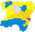
 1982 results map
 -
 1986 results map
 -
 1990 results map
 -
 1994 Scotland results


Modern day use
[edit]Grampian continues to have a regional NHS board. The region also had a regional fire and rescue service and Police service before they were merged into Scottish Fire and Rescue Service and Police Scotland respectively in 2013.[8] Grampian also had its own Television region called Grampian Television until it was dissolved and incorporated in STV North in 2006.[9]
Successor council areas
[edit]| Council area | Composition in terms of districts specified by the 1994 act |
|---|---|
| Aberdeen City (Named 'City of Aberdeen' by the 1994 act but changed its name to 'Aberdeen City' prior to the changes coming into force) | City of Aberdeen |
| Aberdeenshire | Banff and Buchan, Gordon, Kincardine and Deeside |
| Moray | Moray |
Premises
[edit]
The regional council was based at Woodhill House in the western suburbs of Aberdeen. The site had formerly been occupied by a large house, which had been bought by the old Aberdeenshire County Council in 1967. The new building was designed in 1971 to be a headquarters for the county council, to replace its old offices at County Buildings in the centre of Aberdeen. The possibility that local government reform may be coming was taken into account in the design of the building, which was completed and occupied in phases from early 1975 onwards.[10][11] An official opening ceremony for the building was held in May 1977.[12]
On the abolition of the regional council in 1996 the building passed to the new Aberdeenshire Council.
See also
[edit]References
[edit]- ^ "Local Government (Scotland) Act 1973", legislation.gov.uk, The National Archives, 1973 c. 65, retrieved 3 January 2023
- ^ "The Educational Endowments (Grampian Region) Transfer Scheme Order 1996". legislation.gov.uk. Retrieved 28 December 2022.
- ^ "No. 23789". The Edinburgh Gazette. 26 May 1995. p. 1332.
- ^ "Local Government etc. (Scotland) Act 1994", legislation.gov.uk, The National Archives, 1994 c. 39, retrieved 3 January 2023
- ^ "Grampian Regional Council". Grampian-Houston Association. Retrieved 28 December 2022.
- ^ a b "Compositions calculator". The Elections Centre. Retrieved 19 February 2023.
- ^ "Grampian Regional Council". Grampian-Houston Association. Retrieved 23 August 2024.
- ^ "Praise after fire service merger". The Herald. 13 November 2013. Retrieved 6 January 2017.
- ^ "Scottish TV and Grampian TV to merge identities". Press Gazette. 2 March 2006. Retrieved 28 December 2022.
- ^ "County HQ plans go on show". Aberdeen Press and Journal. 10 July 1971. p. 17. Retrieved 23 August 2024.
- ^ Dunbar, John (27 December 1974). "New HQ waits for council changeover". Aberdeen Press and Journal. p. 9. Retrieved 23 August 2024.
- ^ "Woodhill House, Westburn Road, Aberdeen". Aberdeen City Council. Retrieved 29 December 2022.
External links
[edit] Media related to Grampian at Wikimedia Commons
Local government areas of Scotland, in use 1975 to 1996 | ||
|---|---|---|
| Borders |  | |
| Central Region | ||
| Dumfries and Galloway | ||
| Fife | ||
| Grampian | ||
| Highland | ||
| Lothian | ||
| Strathclyde | ||
| Tayside | ||
| Island areas1 | ||